North Fork St. Joe: Loop Creek to Avery
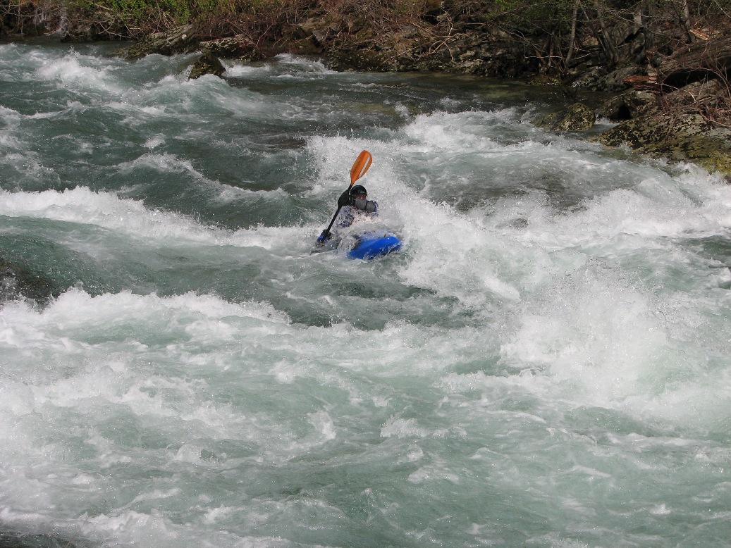
No Sweat rapid - Copyright Todd Hoffman 2023
Run Description:
The North Fork, referred to locally as the Little Joe, can be run 10 miles from Loop
Creek to the confluence with the main St. Joe at the town of Avery. The run is
informally divided into two, 5-mile long sections: the upper from Loop Creek to
Telichpah Campground (Squaw Creek Camp or North Fork Camp on older maps), and the
lower from Telichpah to Avery. The majority of the whitewater is found
on the upper section, but running both the upper and lower together is the best
option for rafts.
The first major rapid on the upper section is where a high bridge crosses over a side canyon on river left.
It is a long class III in a deep gorge that ends in a headwall. About two miles
above Telichpah Campground is the stand out rapid on the run, No Sweat. It is a very long class III+ drop with
the crux move on a sharp, 90 degree, right-hand bend. No Sweat is located near Tunnel #33, which is
the tunnel with a small waterfall on the upstream end.
Just above Tellichpah Campground is another nice class III drop, that ends at the take out
beach for the upper. Immedeately below Telichpah are a couple of class long II/III rapids.
The stand out rapid on the lower section is Humdinger, located a short distance above Avery
where the road passes through a tunnel. Its not easily visible from the road due to
the tunnel. At very high flows (>10,000 CFS at Calder) a large, powerful hole forms here.
The North Fork is a great river for intermediate paddlers with class solid class III skills. It
offers a mix of long sections of class II swift water with a some stand out class III rapids, combined with great scenery and fun play opportunities.
The North Fork is a great way to kick off the paddling season, and is a good option when other creeks in the
area are too high. Always be on the look out for new wood and scout carefully.
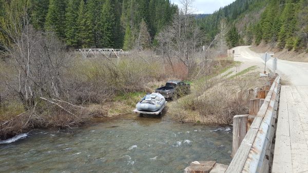
Loop Creek Boat Ramp - Copyright Todd Hoffman 2023
Logistics:
Exit Interstate 90, at Wallace, Idaho (visitor's center exit). Work your way south
through town, up Placer Creek to Forest Service road 456. Take 456 (dirt) over Moon
Pass (elevation 4,931'), and down the North Fork to Loop Creek (approximately
20 miles from Wallace). Hide your gear in the brush if you leave it unattended at
Loop Creek while you shuttle. Boats have been stolen here.
Moon Pass generally doesn’t open until the last week of May or first week of June,
depending on snow pack. For early season runs, or for those coming from the
South, best Access is from St. Maries, Idaho. It is 47 miles from St. Maries
to Avery, all on good paved road.
To get to the Telichpah Campground access point, continue 5 miles down river from Loop Creek.
You’ll know you’re there when you cross the second high bridge that spans the North Fork.
Turn off to the right (west) immediately after the bridge, and continue down
river a short distance to a wide turn out / camp. To road scout the run
while setting your shuttle, cross to the West (river right) side of the North Fork at the Loop Creek
Bridge, and take the “lower” road down to Telichpah.
The Avery take out is 10 miles below Loop Creek, and around 5 Miles below Telichpah.
There is a take out spot at the garbage dumpsters just above the confluence, but if
you use it don’t block access. Park just down the road. Note that all river frontage
in the town of Avery is private property. There is an
excellent pizza restaurant in the town of Avery for a post float lunch and a cold beer.
Video: "No Sweat" Rapid
Flow Information:
There is a hand painted gauge on the piling of the hi-way bridge at the confluence of the North Fork and the main St. Joe at Avery. Minimum level is around 1 foot. As a rule of thumb, look for at least 4,000 CFS on the USGS St. Joe at Calder gauge for the North Fork to be running. Runs are possible as early as April depending if road is clear of snow. The season is usually done by mid June. At flows above 3' the run starts getting juicy, becoming more continuous in nature.
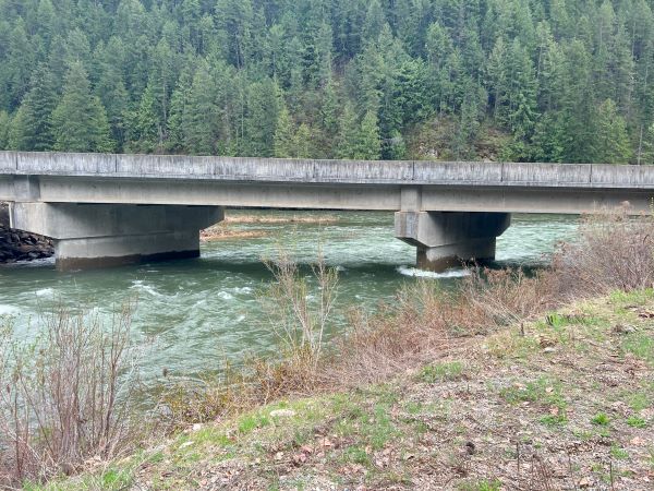
Bridge gauge at main St. Joe confluence.
Stream Stats:
| Ave Gradient: | 50 fpm |
| Max Gradient: | 79 fpm |
| Distance: | 10 |
| Difficulty: | III+ |
| Consequences: | III+ |
| Min Level: | 1' |
| Season: | May - Jun |
Planning Tools:
Key Places:
Recommended Reading:
Crowell, Sandra and David Asleson.
Up the Swiftwater:A Pictorial History of the Colorful Upper St. Joe River Country. Museum of North Idaho Publications, 2003.
Egan, Timothy.
The Big Burn:Teddy Roosevelt and the Fire that Saved America. Haughton Milflin Harcourt, 2009.
Hoffman, Todd.
"Locals Favorite: St. Joe Drainage."American Whitewater Journal July/August (2006):12-15